 |
 |
 |
When news of SIR-A's x-ray like abilities reached the news media, phones
started ringing off the hook at NASA's Jet Propulsion Lab. "We started getting
calls from people saying, 'I know where Atlantis is,' and, 'If you guys give me
the data, I'll find my Grandmother's buried treasure,' and so on," laughs Ron
Blom. "What people didn't realize was that the radar could only penetrate
about 10-15 feet and could only accomplish this through exceedingly dry and
fine-grained material—like desert sand." Even so, SIR-A demonstrated the
enormous power of space-borne imaging for archaeologists.
In recent years, the technology has only become more sophisticated. There are
now five Landsat satellites orbiting the earth (not to mention the numerous
imaging satellites belonging to other countries in orbit). Landsat 4 and
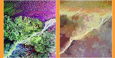
Landsat 5 are equipped with something called "Thematic Mapper," which can radio
seven channels of digital data back to earth—three in the visible spectrum,
three in the reflective infrared spectrum and one in the thermal infrared
spectrum.  This multi-spectral data, especially when enhanced by computer
processing, can detect the slightest variations in the earth's surface—like
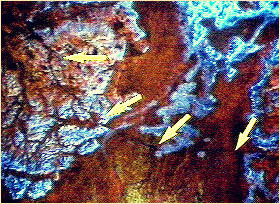
the trail leading to the Ubar site. "The surface material of the incense trail
basically had fewer rocks, more sand, and more dust than the surrounding
desert," explains Ron Bloom. "That, maybe along with a couple thousand years of
camel dung, stood out extremely well at the longer wavelengths." This multi-spectral data, especially when enhanced by computer
processing, can detect the slightest variations in the earth's surface—like
the trail leading to the Ubar site. "The surface material of the incense trail
basically had fewer rocks, more sand, and more dust than the surrounding
desert," explains Ron Bloom. "That, maybe along with a couple thousand years of
camel dung, stood out extremely well at the longer wavelengths."
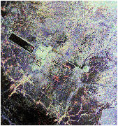
Radar imaging has also undergone a dramatic technological advance. SIR-A was a
single-band radar while SIR-C, which flew twice in 1994, is a multi-wavelength
radar. Its particular strength is detecting subtle differences in the earth's
topography and penetrating some surface materials, especially sand, leaves and
ice. One of SIR-C's recent targets was the ancient city of Angkor in Cambodia. The radar's longest wavelengths were able to partially penetrate the dense
jungle vegetation and pick up details of the topography hidden below. As a
result, researchers were able to identify water reservoirs and moats around the
temple complexes that hadn't been visible from the ground. Similarly, recent
radar images of the Great Wall of China found an earlier piece of the Wall—long suspected to have existed, but never located—buried under dirt and
sand.
Experts are quick to warn that remote sensing, though extremely useful in some
cases, is not a silver bullet. "The Ubar site was found by a combination of
historical research, remote sensing data and a lot of hard work by guys like
Juris Zarins," stresses Ron Bloom.
Zarins agrees with Blom, but is clearly a fan of the new technology. "Remote
sensing allows you to get a picture of the terrain you otherwise wouldn't see.
It gives you a better feel for what the terrain is like and where the
possibility of finding sites are. And when it's put together with GPS (Global
Positioning System) and you're able to tell an automobile driver or a
helicopter pilot, 'Go to this site at these coordinates,' and they can drop you
right off there, it's very very helpful."
Lost City Home | Remote Sensing | Interview | Desert Finds
Artifact Gallery | Map | Links
|
|
|