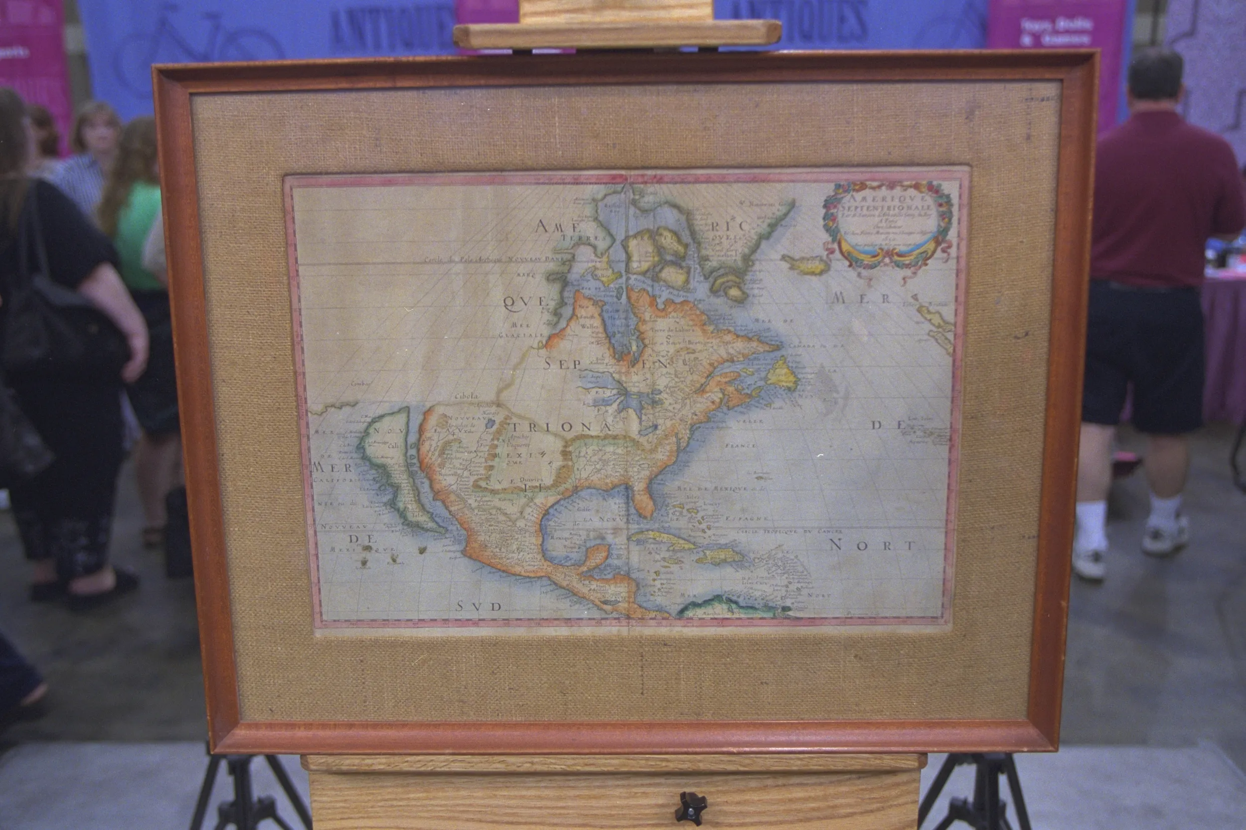
GUEST: Well, I brought a map that my grandfather bought some time ago. Um, and, uh, I don't know much about it, to tell you the truth. He collected maps, so we have about, ah... Six or seven old maps of the Chesapeake Bay. This was the oldest one, and that's why I brought it in.
APPRAISER: Coming here to Winterthur, I was hoping that we would get a map like this. This is the first map of the colony of Maryland, including Delaware, and it's a 1671, genuine John Ogilby-Arnoldus Montanus map of the colony. Here we have the Calvert seal, and the dedication to Lord Baltimore, Cecil Calvert. We know it's a genuine map because it has a nice center fold down the middle and a nice plate mark around it. And it's on the right paper for the time, It has quite nice margins. And the paper tone is nice, if a little bit toned.
GUEST: When did maps start being always with north of the top? This one obviously has north this way.
APPRAISER: Even in the 17th century, it was the convention to have maps with north at the top. But you have on these maps of the coast of America this interesting convention of pointing them with west at the top. My understanding is that that's because the settlers would have been facing that direction when they were coming from Europe. And so you'd want to see the land as it was laid out in front of you. Do you have any sense of the value of the map?
GUEST: None whatsoever. You know, I didn't think it was going to be worth much until I got chosen to be on the show. Now I think it's probably worth more than I originally thought.
APPRAISER: What did you originally think it was worth?
GUEST: Oh, I thought somewhere between... I, I said $500, the guy sitting, waiting with me said $750, so, I decided I was going to tell you $625.
APPRAISER: Well, at retail, this map would go for about $6,500.
GUEST: Wow.