Maya
- Posted 01.09.07
- NOVA scienceNOW
(This video is no longer available for streaming.) This NOVA scienceNOW video shows how experts are using NASA satellite photography to find ancient Maya architecture hidden deep in the rain forest of Guatemala. It's a marriage of 21st-century technology and centuries-old archeological techniques that has already unearthed some striking Maya remains, including a jungle-covered temple containing an extremely rare, 2,000-year-old mural.
Transcript
MAYA
PBS Airdate: January 9, 2007
WILLIAM SATURNO: It's difficult to convey what this place would have been like when it was inhabited. As you look out around, none of this rainforest was here at that time. Instead, you were looking at this bustling metropolis of 100,000 people gathered here: the sounds, the smells, smoke rising up from the houses, the thousands of houses that littered the countryside.
PETER STANDRING (Correspondent): For 1,200 years, the Maya civilization dominated Central America, and here, in the jungles of northern Guatemala, the great city of Tikal was one of the wonders of the New World, with centuries of art, architecture and astronomy while Europe was still in the dark ages. Limited by poor farmland and a yearly drought, the Maya somehow supported a population that numbered in the millions. But just at the peak of Maya power, their world suddenly fell apart, about 12 centuries ago.
How such a civilization could collapse so quickly remains one of the great unsolved mysteries of archeology. Tikal lasted for 1,000 years, but somehow it reached a tipping point where it could no longer support its population. And so, within a generation or two, 80 percent of the people who lived here disappeared.
WILLIAM SATURNO: Within about 40 years of this city's height, we see this place almost entirely abandoned. And trees were beginning to grow on the surfaces where kings once walked.
PETER STANDRING: For archeologist Bill Saturno, understanding the end of the Maya civilization has always involved finding evidence of how it began, 3,000 years ago. In the spring of 2001, he and a group of local guides were hot on the trail of three rare carved monuments; so eager to find them, they nearly met their own end.
WILLIAM SATURNO: The rumor was that this site was only one day's journey away. And so we planned a journey of a day, and we brought food and water for one day. And it turned out that the journey was three days. Now, how one gets two days into the woods without food or water is that they need to make a series of bad decisions. In fact, they need to be committed to making bad decisions again and again and again, because there are opportunities to turn back, and you simply don't.
PETER STANDRING: But turning back would have caused Saturno to miss the discovery that changed his life, as his group wandered into the ruins of a small Maya city in an area the locals called San Bartolo. There, among the buried Maya buildings was an 80-foot pyramid with a deep trench that looters had cut into its side. Saturno had stumbled on an ancient temple, but in his dehydrated state, it simply meant relief from the hot sun and 100-degree heat.
WILLIAM SATURNO: I thought to myself, "It's got to be much cooler inside there, and if I just crawl into that, I can sit down, it'll be shady and, and at least I won't feel as bad as I feel now." And I walked in past where the light entered, and I sat down, just in the darkness. And when I shone my flashlight up on the wall, I saw the face of the Maya maize god there.
PETER STANDRING: Despite his exhaustion, Saturno still knew he was looking at an incredible find.
WILLIAM SATURNO: This was clearly the discovery of a lifetime, but pity my life will be so short. I thought that when I sort of laid down to rest, that I was lying down to rest for the final time.
PETER STANDRING: As the expedition's most experienced guide, Anatolio Lopez knew the situation was dire.
ANATOLIO LOPEZ (Guide, Proyecto San Bartolo): And then I went out to see if I could find something that would ease the thirst. So I found a flowering plant they call Pinuela.
PETER STANDRING: The fruit of the Pinuela measures only a couple of inches, but its moisture saved Saturno's life and got the group moving again, revived enough to walk out of the rainforest alive. Bill Saturno had discovered the oldest Maya paintings ever found, depicting religion and government as far back as 100 B.C.
WILLIAM SATURNO: The murals at San Bartolo are really our earliest example of this relationship between god and kings, spelled out in this wondrous work of art. And these are the earliest hieroglyphic texts we have in the Maya lowlands. They predate the text that we can read by five centuries.
PETER STANDRING: Can you think of an analogy, in terms of the impact, something like this has?
WILLIAM SATURNO: Well, I mean, essentially, this would be like finding sort of the story of Christ, but written at the time of Christ.
PETER STANDRING: News of Saturno's discovery quickly spread to Maya experts everywhere.
TOM SEVER: Well, we had heard that Bill had come across something major, that he had...what ultimately became the discovery of the murals.
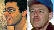
PETER STANDRING: Tom Sever is the only archeologist on the NASA payroll using the space agency's aircraft and satellites to survey ancient sites on the ground. It's a technology called "remote sensing," and it can reveal hidden details in the landscape below. From space, satellites record invisible wavelengths like infrared. What we perceive as heat, satellite cameras turn into light.
TOM SEVER: It can see beyond the range of our vision. It can detect features that we can't see. And through the use of computers, we can record that invisible information and bring it back into visible light.
PETER STANDRING: Using remote sensing, Sever proved the Maya used innovative agriculture on land poorly suited to grow crops. Satellite photography peered through layers of the modern rainforest to reveal intense cultivation, connected by a pattern of ancient roadways.
TOM SEVER: From the perspective of space, we can look down, and we can see how the Maya were able to feed this intense population. We could see the Maya roadways, causeways. We could find their water reservoirs, water storage areas and canal systems.
PETER STANDRING: The images charted areas right next to Bill Saturno's excavation at San Bartolo. And when Tom Sever sent satellite maps to help his colleague, Saturno immediately noticed one very curious detail in the satellite imagery.
WILLIAM SATURNO: In looking at the satellite image, it immediately became clear to me that the forest in San Bartolo was of a lighter color than the forest outside of San Bartolo. And so, in looking farther afield, looking across that image, you could see other areas that shared that same color. And, of course, the thought is, "Well I wonder if those are archaeological sites too."
PETER STANDRING: So with a GPS locator in his hand, Saturno plotted a course to the other brightly colored spots on his NASA map, scattered all over the landscape.
WILLIAM SATURNO: And as you get closer to them, you're saying to yourself, "In 10 meters, we should be walking into an archaeological site. Now, if this works, we have five meters to go until we find architecture. And then you walk that five meters and sure enough, you walk up onto a Mayan building.
PETER STANDRING: Buried under a thousand years of vegetation was the unmistakable shape of a Maya pyramid, precisely where the satellite image had predicted it would be. Saturno found three Maya sites around San Bartolo in the areas where the maps showed a change in the color of the vegetation. He reported back to Tom Sever, it seemed to work every time.
TOM SEVER: We were skeptical at first. We had no doubt that this was working sometimes, but that it was working accurately all the time, we just couldn't buy into that. So as we started looking at the imagery, we started wondering, "What's causing that in the vegetation?"
PETER STANDRING: Sever theorized that, over the centuries, the limestone that the Maya used as building material had seeped into the soil, changing the vegetation growing on Maya sites, but nowhere else. The chlorophyll in plants glows brightly in infrared, and satellite cameras picked up that subtle difference.
TOM SEVER: If this was true, this is big news. I've been working on Mayan archaeology for a long time, and we've had great success, but this would be the crowning achievement, if we were able to map where all the Maya sites were.
PETER STANDRING: There was only one way to find out. Sever came down to Guatemala to join Saturno, to see for himself. The road to San Bartolo runs 50 kilometers through the seasonal wetlands called "the Bajos."
WILLIAM SATURNO: Once the rains start, the Bajos become impassible.
PETER STANDRING: They need to push beyond San Bartolo to remote locations never explored by archeologists. But it's already becoming a very long day.
WILLIAM SATURNO: We spent more than two hours in four vehicles, with winches and people pushing, and we achieved less than a kilometer.
PETER STANDRING: After several days, and on drier ground, the archeologists use only the NASA maps to thread their way deep into the rainforest, towards a bright site on the satellite image: the brighter the color, the more Maya limestone, the bigger the potential site. But would the theory actually work?
TOM SEVER: It was just mind-blowing. We're in this dense vegetation, incredibly hot, 119 degrees.
You see it?
WILLIAM SATURNO: We should be right there, but, we're in it.
TOM SEVER: We're close.
WILLIAM SATURNO: And we get about 10 meters away from where the site is supposed to be, but I don't see an archaeological site. I thought, "Oh," You know? "Great."
TOM SEVER: No indicator, and, my thought was, again, this, you know, "Why am I out here? Why did I fall for this?"
WILLIAM SATURNO: "So this is the time it doesn't work. They're really going to think I'm nuts. I bring them all the way down here, we're going to go out and find this place, Ten meters, nothing."
TOM SEVER: And then, five meters, we'd move forward, and there's a giant temple, right on target.
WILLIAM SATURNO: Fourteen hundred years, that's been here.
TOM SEVER: We did this for many days. We saw many sites, with incredible accuracy, and I became absolutely convinced.
WILLIAM SATURNO: Pretty impressive structures—two stories, from the first floor to the second floor.
PETER STANDRING: The satellite imagery was flawless. The huge temple was exactly where the map coordinates predicted it would be.
WILLIAM SATURNO: This is a pretty impressive room. These walls are a good two meters high. It's a great vault.
TOM SEVER: The paint hasn't faded too much.
WILLIAM SATURNO: You can see it's really thin plaster that they're using. It's in great shape, but you can tell it's a resource that's really at its end.
PETER STANDRING: The site at San Bartolo has now become a pilgrimage for shamans of the Maya religion, descendants of the ancient civilization that once ruled here.
It's pretty incredible that satellites miles and miles and miles up in space are seeing things that you and I can't see here.
WILLIAM SATURNO: This is revolutionary, and it changes the entire way that we approach archaeology in a tropical environment.
PETER STANDRING: Thanks to the collaboration of archeology and space technology, scientists are beginning to learn how the Maya conquered this harsh landscape as no modern civilization ever has, and how they, quite suddenly, lost control of it.
TOM SEVER: Now, from space, we can see where these sites are. And now we have enough material to understand the rates of deforestation that might have taken place here—as a result from the construction of all of these buildings and temples and roadways—and ultimately contributed to their own drought, their own destruction.
WILLIAM SATURNO: All of a sudden, for the first time, we're able to look at the big picture and understand the extent to which the Maya expanded these cities.
When you think about how many sites are out there, just in the Mayan lowlands...And we can see how many there are in these satellite images. Think about how many San Bartolos are out there waiting to be discovered.
Credits
Maya
- Edited by
- Stephen Mack & Ben Ehrlich
- Produced and Directed by
- Dean Irwin
NOVA scienceNOW
- Executive Producer
- Samuel Fine
- Executive Editor
- Neil deGrasse Tyson
- Senior Series Producer
- Vincent Liota
- Supervising Producer
- Stephen Sweigart
- Editorial Producer
- Julia Cort
- Development Producer
- Vinita Mehta
- Program Editor
- David Chmura
- Post Production Supervisor
- Win Rosenfeld
- Unit Manager
- Candace White
- Associate Producers
- Mica McCarthy
- John Pavlus
- Win Rosenfeld
- Anna Lee Strachan
- Production Secretary
- Fran Laks
- Animator
- Brian Edgerton
- Compositor
- Yunsik Noh
- Camera
- Edward Marritz
- Robert Hanna
- Anthony Forma
- Peter Bonilla
- Stephen McCarthy
- Sound Recordists
- Alex Sullivan
- Michael Karas
- Mark Mandler
- Steve Jones
- Rusty Duggan
- Audio Mix
- John Jenkins
- Colorist
- Jim Ferguson
- Animation
- Sputnik
- Vincent Liota
- Space elevator animation by Space Elevator Visualization Group
- Visual Effects Supervisors
- Alan Chan
- Lee Stringer
- Digital Artists
- Eki Halkka
- Michael Cliett
- Matt Zeyn
- Jeff Leroy
- Jackson Yuen
- Consultant
- Brad Edwards
- Additional Editing
- Patricia Stern
- Win Rosenfeld
- Music
- Rob Morsberger
- NOVA scienceNOW Series Animation
- Edgeworx
- Archival Material
- Philip Baird/AnthroArcheArt.org
- Robert Frerck/Odyssey Productions/Chicago
- Getty Images
- HarperCollins Publishers, Inc. (Arthur Clarke recording)
- NASA
- Longevity Study Participants
- Barbara Brody
- Irma Daniel
- Sylvia Goldberger
- Frances Horowitz
- Toby Kirsh
- Louis Levinson
- Arthur Stern
- Special Thanks
- Harry's Coffee Shop
- Mike Jorgenson/WPRB
- Jason Saunders
- Arthur C. Clarke
- Rohan de Silva/The Arthur C. Clarke Foundation
- Oak Ridge National Laboratory
- Ray Baughman
- University of Wollongong
- The Space Needle Corporation
- Wirefly X PRIZE Cup
- LiftPort, Inc.
- Neil deGrasse Tyson
- is director of the Hayden Planetarium in the Rose Center for Earth and Space at the American Museum of Natural History.
- NOVA Series Graphics
- yU + co.
- NOVA Theme Music
- Walter Werzowa
- John Luker
- Musikvergnuegen, Inc.
- Additional NOVA Theme Music
- Ray Loring
- Post Production Online Editor
- Spencer Gentry
- Closed Captioning
- The Caption Center
- NOVA Administrator
- Ashley King
- Publicity
- Eileen Campion
- Anna Lowi
- Yumi Huh
- Lindsay de la Rigaudiere
- Researcher
- Gaia Remerowski
- Production Coordinator
- Linda Callahan
- Unit Manager
- Carla Raimer
- Paralegal
- Raphael Nemes
- Legal Counsel
- Susan Rosen Shishko
- Assistant Editor
- Alex Kreuter
- Associate Producer Post Production
- Patrick Carey
- Post Production Supervisor
- Regina O'Toole
- Post Production Editor
- Rebecca Nieto
- Post Production Manager
- Nathan Gunner
- Producers, Special Projects
- Susanne Simpson
- Lisa Mirowitz
- Coordinating Producer
- Laurie Cahalane
- Senior Science Editor
- Evan Hadingham
- Senior Series Producer
- Melanie Wallace
- Managing Director
- Alan Ritsko
- Senior Executive Producer
- Paula S. Apsell
This material is based upon work supported by the National Science Foundation under Grant No. 0229297. Any opinions, findings, and conclusions or recommendations expressed in this material are those of the author(s) and do not necessarily reflect the views of the National Science Foundation.
NOVA scienceNOW is a trademark of the WGBH Educational Foundation
NOVA scienceNOW is produced for WGBH/Boston by NOVA
© 2007 WGBH Educational Foundation
All rights reserved
- Image credit: (space elevator) Courtesy Bradley C. Edwards/Space Elevator Visualization Group
Participants
- Anatolio Lopez
- Guide, Proyecto San Bartolo www.sanbartolo.org/
- William Saturno
- University of New Hampshire www.sanbartolo.org/
- Tom Sever
- Archeologist, NASA www.ghcc.msfc.nasa.gov/personnel/ghcc_personnel_sever.html
- Peter Standring
- Correspondent
Related Links
-

Maya: Expert Q&A
Archeologists Bill Saturno and Tom Sever answer questions about the mural, using satellites to find lost sites, and more
-

Profile: Julie Schablitsky
Meet an archeologist who is helping to rewrite the history of the Donner Party and the Old West.
-

Traces of the Donner Party
Archeologist Julie Schablitsky describes what she and colleagues discovered at the Donner family campsite.
-

Julie Schablitsky: Expert Q&A
Historical archeologist Julie Schablitsky answers questions about her life and work.


